Saturday, 27 June 2015

Killin

This really was Mike's trip (northernpies.blogspot.co.uk), however, he very kindly invited me to tag along. The aim of the trip was to walk some of the hills around Killin. Mike was particularly interested in a few Corbet's and one or two lesser tops.
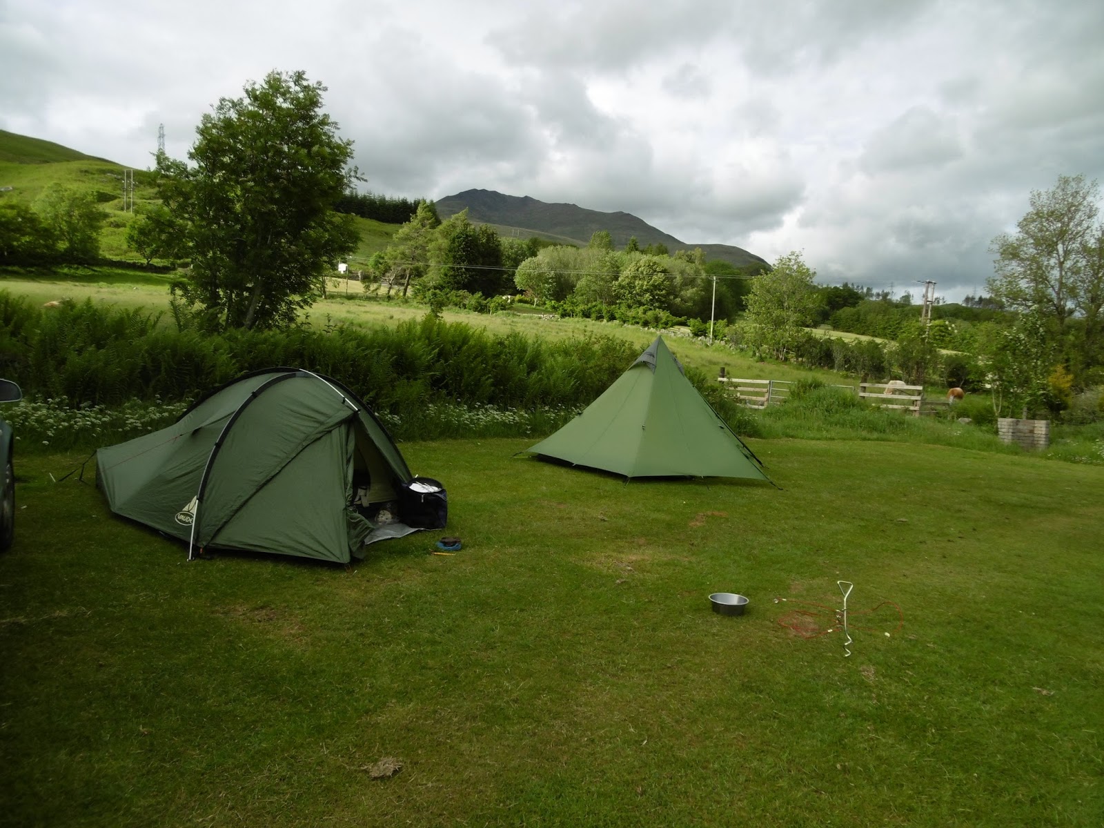
With Mike collecting me around Sunday lunchtime, we where soon heading north. It is a long run up to Killin. This was to be a fixed campsite based near the village.Campsites are not my favourite places and I was a wee bit apprehensive. However, when we booked in, the farmers wife just pointed us in the direction we where to go and left us to it. The camping area was deserted and we soon found a suitable spot and set up camp.

Monday was a blustery day and non too warm. A leisurely breakfast and we where soon heading up a narrow twisting road that snaked high up the hillside. it was a case of windproofs on over layers. The wind was chilly. Lucky was obviously impressed with this form of walkies as he bounced around in joyful exuberance. The local sheep though where off and running although Mike always keeps him on a lead.


Our way led us upwards, for me it was a somewhat slow plod. Little time was spent on Meall Luaidhe. With the wind being fairly strong, we where soon heading across to Meall Nam Maigheach. Seeking shelter in a nice dry peat hag we stopped for lunch and took time to appreciate the stunning scenery. Lucky, not bothered with the scenery, took to excavating a cosy nest for himself.


Our third top of the day was Meall nan Eun. A short day, we where back at the campsite by mid afternoon.
Lucky in his doggy buff.


Tuesday morning saw a glorious sunrise. The early morning sunlight striking the front of the tent, The air was alive with the sound of bird song. Flocks of oystercatchers with strange, piping cries swirled around overhead. The raucous cry of crows and the screech of gulls intermingled with the song of finches, blue tits and other small birds. A pair of herons spiralling high, riding the thermals.


In contrast to the previous day, Tuesday saw us in shorts. Once more we where heading over the 'Not for nervous drivers' road. With the car parked in Glen Lyon, we made our way upwards on a rough estate track that followed the  Allt a' Choire Uidhre. It was hot, sticky going as we climbed ever higher. Finally a badly eroded path swung off from the track. It rose steeply up the hillside toward the distant ridge. The path proved to be wet and boggy with many loose rocks. Slowly, slowly, we rose higher and higher. Large snow patches lay just below the ridge, much to Lucky's delight.

. A keen breeze was rippling across the ridge but oh my, what a delight to be up there. Soon we were on the craggy summit of Cam Chreag. A Corbet and Mike's fiftieth. Glorious views all round, savoured slowed slowly as we had our lunch.


Picking our way down needed a wee bit of care. There was no obvious path higher up the steep hillside and much of the ground was very wet and boggy. Crossing a snow bank it was surprising how firm the snow was.


The opposite hill across from us was also bagged by Mike.

This had been a grand day of walking. on the way back Mike had to give a sheep a stern talking to a sheep as it lay in the road, 'I am very comfortable thank you and I have no inclination to move!'
Wednesday morning was wet, grey and dreich. Thus we spent the day wandering around Killin, doing the tourist bit around the Falls of Dochart. Had a wander down an old railway track and then popped in to a 'dogs welcome' cafe for a cup of tea.


We spent the afternoon exploring Glen Lochay. A wonderful glen and it has given me a few ideas for future trips.
We where away fairly early on the Thursday. Once again it was Glen Lyon. This time we were heading up the ancient track that leads over to Loch Rannoch. Unable to find the path we wanted, it was a case of turning off and heading straight up a very steep section of heather covered hillside, picking our way as best as possible. Soon we were on the shoulder of  Meall Glas. An eagle  flying across the distance ridge was spotted by Mike. A huge bird and no mistaking it for a buzzard. From there it was a case of following the remains of an old fence line on up to Beinn Dearg. Another Corbet, no exciting crags on this one, just a rounded hilltop. Rain was heading our way, the distance hills already  looking grey and wet. Thus it was a quick lunch and heading off to take in a smaller, unnamed top and then downwards once more.

 Friday saw us once more heading south.
This then is a summary of our week in Scotland. Mike will soon have a more detailed account in his blog. In the meantime, a few more photos.


Hairy beasties.


Monday, 15 June 2015

Semi slackpack?

Time away of late has been limited. With rumours of summer coming in, it was time to make amends. With the Cheviots just up the road from me and a bus pass, the choice was obvious.
Folks, I must offer a warning, the Cheviots are going to be appearing on a regular basis on these blog pages.
By a variety of buses, I arrived in Wooler early afternoon. It was mild, the sun was shining and I was keen not to be wasting time. Following footpaths and bridleways my footsteps led me over to Carey Bridge. Amazingly I was in shorts and tee shirt, first time this year.

Roughly speaking, I had a tentative outline of a plan. However, there was no rigid itinerary, no fixed route, no particular place I had to be.

The Carey Burn look interesting. There was a marker indicating a footpath. A check of the map, there was nothing marked in the way of a path. A well defined path led me upwards through the narrow valley, it was delightful place. Meeting an elderly couple heading down, we stopped and chatted for a few moments. They mentioned a waterfall higher up but had been unable to reach it, finding the path a little too difficult for them. Once again, nothing indicated on the map, a serious omission by the O.S. people?

There certainly was a waterfall, not a large one but very nicely proportioned, with deep pools and rushing channels.


Following the path higher, I had an idea where it would lead to. That though would wait until the morning. With no rush, it was an easy decision to spend a little time in this pleasant little valley. Dense swathes of bracken made finding a place to camp slightly difficult. There where several places I had passed though and I back tracked a short way to a grassy ledge that proved to be ideally tent sized.

Such simple pleasures in being able to sit outside the tent, a gentle breeze keeping the midges at bay, boots off and a brew of tea on the go.
Following the path upward the following morning, it led to precisely where I suspected it to go. Joining the bridleway that comes directly up from Wooler common. This leads on past Luckenarks and on to Broadstruther.

Here possibly I made an error? Rather than stay with the main tourist route up and over Broadhope Hill, on over Scald Hill and up to the Cheviot, I opted for a more obscure path that led around the back of Broadhope and on to a path that came up from Goldscleugh. In actual fact, that leads on to a forestry track. At first I lost the path a few times. It disappeared in deep heather and bog. However, I knew there was a path that followed a fence line. After a bout of heather bashing and bog hopping I gained the fence and indeed the path was where I knew it would be.
. My aim now was to follow the track that swings around the head of the valley. Following it. an old section of the track, now a rough heathery affair, swings left and upwards, climbing toward the Cheviot ridge.
 A good halfway up and suddenly I hit a brick wall. One moment I was moving slowly but fairly steady, the next I just came to a standstill. This was most frustrating. The day being hot, I had deliberately paid attention to my fluid levels, had been feeling ok up to that point.
Taking on more fluids and a bite to eat, I eased back in the heather and rested for a good half hour. Starting off again, it quickly became apparent that I was finding it hard going. Coming on to a lower ridge, I could see the old track contouring across and up to the cairn on the ridge line. Part of me really wanted to push on. Why though? What was there to gain? It may have been doable, however, it would have been an awful struggle. In the end I opted out. Some may think I was being a wuss, but I had nothing to prove. Instead I picked my way around the hill to where the main path rises steeply upwards. It looked a mess, a scar on the landscape. Two figures could be seen toiling upwards. Instead I turned and headed over to Scald Hill. A peruse of the map saw me heading down toward Langleeford Hope. Once a shepherds cottage, now holiday lets.


My intention now was to try and head up the valley and camp.  It was way above Harthope Linn that I found a spot for the tent. Bracken is not the best of stuff to camp on. It took a bit of time but I eventually settled for a small grassy area where the tent fitted in snuggly.
With the tent up, I actually snoozed for a while. Unfortunately the breeze that had been blowing up the valley died away. This brought the midges out. A  bite of supper and a cuppa was followed by a retreat to the tent.
Rain in the early hours pattered softly on the flysheet. By morning it was dry once more, but much cooler and overcast. The rest of the day was spent pottering. Returning to the tent early afternoon the temperature had  noticeably dropped, it was much colder.


By mid afternoon the cloudbase  was cloaking the tops of the surrounding hills. A small group of folk heading down told me they had had to don extra layers higher up and that the fog had meant navigation interesting?

Early evening saw the cloud base descending further with rain now sweeping up the valley.
It remained wet all night. A bout of what is becoming a normal problem for me, meant I got wet and very cold twice during the night hours.

Thick, grey cloud covered all like a shroud the following morning. It was not raining, as such, just a cloying wetness. There was only one option, put the kettle on and have a brew!
The folk I had spoken to the previous day had told me that the forecast was for it to clear by the afternoon. It was an easy call and the morning was spent snoozing, reading and drinking tea. Amazingly things actually did start to clear by late morning. By the afternoon I was heading down the valley. A delightful walk with no rush to be anywhere. My intention originally had been to camp but I really wanted a hot shower. Thus it was I made for Wooler and the youth hostel.


A mixed few days, well worth getting away though.

A few more photos, enjoy.


Tuesday, 9 June 2015

Suggestions

Something I have noticed in my wanderings around the hills is the increasing amount of tissues, toilet paper and even worse, human excrement scattered far and wide. Often this mess is half heartedly covered with a loose rock or a few stones, paper and worse poking out from the edges. Apart from the fact it is unsightly, it is also unhygienic.
Now, I am sure the majority of backpackers are responsible folk and take appropriate measures. However, despite probably preaching to the converted, there are few items every person who walks in the countryside, and here I include those out just for a days walking. A small stuff sack or similar, in it a supply of toilet paper. It need not be a complete loo roll. Andrex sell 'On The Go' toilet tissue, sheets of tissue with no cardboard tube. They can be picked up in larger chemists. Also Coghlan's sell a similar item, obtainable from many outdoor shops. A small trowel, it does not need to be anything fancy or large. All that is required is that it is suitable for digging a small cat hole. A small bottle of hand gel for reasons of hygiene. Some backpackers also carry a lighter to burn toilet tissue. Have your toilet bag to hand as well. it is no good down the bottom of the rucksack.
Possibly stating the obvious, choose a place away from areas frequented by people, also, well away from water sources. Ladies, other items must be carried out. Always have a spare polythene bag to hand.
The golden rule is, leave no trace. Something I may add here. As someone who has had long term health problems for a fair while now, when wild camping, I now prepare and dig a cat hole well away from the tent when setting up camp. It is handier than stumbling around in the middle of the night in bad weather conditions, frantically trying to find somewhere to go by head torch. Just remember where you dug your scrape. If you do have to get up in the night, check in the morning that indeed everything is as it ought to be.
As I have said, the majority of backpackers abide by these unwritten codes of behaviour. However, we must all act responsibly.
We still have giardia and such like parasites, free water in the hills. In some countries even the remotest areas have polluted water.
As I say, just a few suggestions..


Saturday, 6 June 2015

Simonside hills.

Mike had placed the Simonside Hills on his list a while back. The aim for the walk was  to be a reccy for a guided walk in the near future. From a distance the ridge line appeared a tad foreboding. However, the ascent upwards was a gradual plod, predominantly on a paved path. This extent of path paved over indicates the popularity of the area.


An undulating meander led us over to Simonside itself.

The rocky outcrops along the ridge offered many hidden features. One could spend many hours exploring the multitude of nooks and crannys.


 A pause for lunch and then a steep descent on loose, stony ground Gone now was the stone flagged paving. A well defined path through the heather led us past Ravens Haugh and on to the stone enclosed trig point of Tosson Hill. Another wee break, how glad I was that I had carried an extra couple of bars of chocolate!
A rough, narrow path, in places boggy, some areas churned by tractors and all terrain vehicles. These where grouse moors and large patches of heather had been recently burned, giving a patchwork appearance to the landscape. Joining a bridleway just below Whitefield Hill, our route now lay through large areas of forestry, some of it cleared. What a mess left behind though, all the brash timber just left lying. Surely it could be chipped and used for wood fired boilers or something?
Forestry tracks led us on past Chartners to Fallowlees. Here we joined St Oswald's Way. More paths and tracks through  forestry. A roe deer bounding away at our approach. Once again entering open moorland, we pressed on past Spylaw and finally descended back to the car park.
 It had been a long day. Mike has estimated it at around thirteen miles. Once he has done the calculations I will update on that.
A fantastic day's walking, the weather remained dry but I must admit to being wearied.

Wednesday, 3 June 2015

Wind blown around Ingram

The hills around Ingram in Northumberland are not particularly large hills. However, they do offer open, rolling moorland with sweeping vistas that can be a delight to view.
A suicidal red squirrel gave us a momentary fright. It appeared hopping across a cattle grid in front of us. Mike stopped the car to allow the squirrel to pass, instead it headed under the the car. Fortunately it suffered no harm and passed on its way.
A strong wind was blowing down the valley, the strength of it becoming apparent when Mike opened the car door and almost had it torn from his grasp.


An initial steep climb and then a steady plod brought us to Hartside hill. Ancient settlements nearby marked by the grass covered crumbling ruins of old walls. Old forts and ancient settlements abound in this area.
The head on buffeting wind meant we did not linger long and we descended down toward the river Breamish to find a sheltered spot for a bite of lunch. Following the river upstream we headed for a bridge. Unfortunately the said bridge was over an adjoining stream. Boots off, trousers rolled up we eased in to the water. Pale legs standing out against the peat coloured water. The current, strong, the water knee high. We safely made it to the other side, albeit with cold feet. Even Lucky took to the water with equanimity.


Once more we headed uphill toward Chesters. This time with the wind behind us.


Our way on led us past more ancient dwellings and forts. Upwards to Cochrane Pike and then back down, over Ewe Hill and on to Brough Law.  An impressive tumble of stones where once stood an ancient fort.
A very good day and many thanks to Mike.